


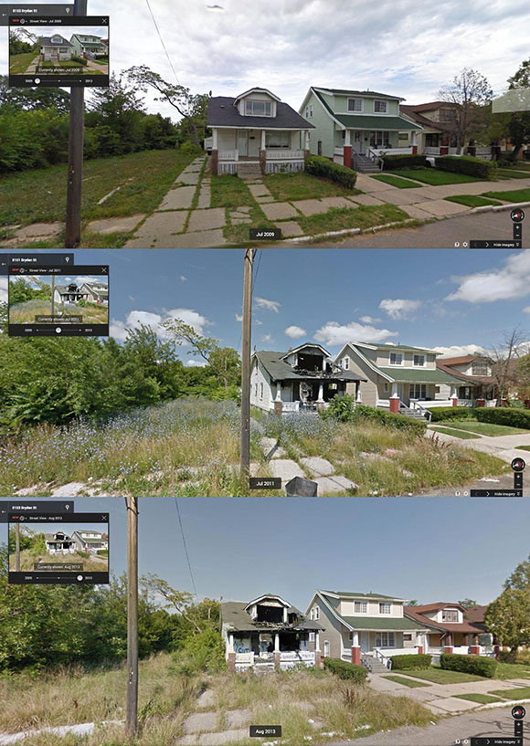
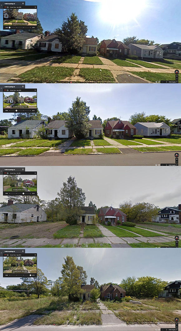
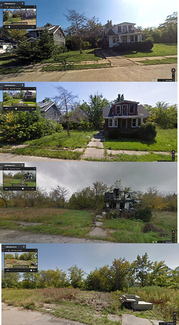
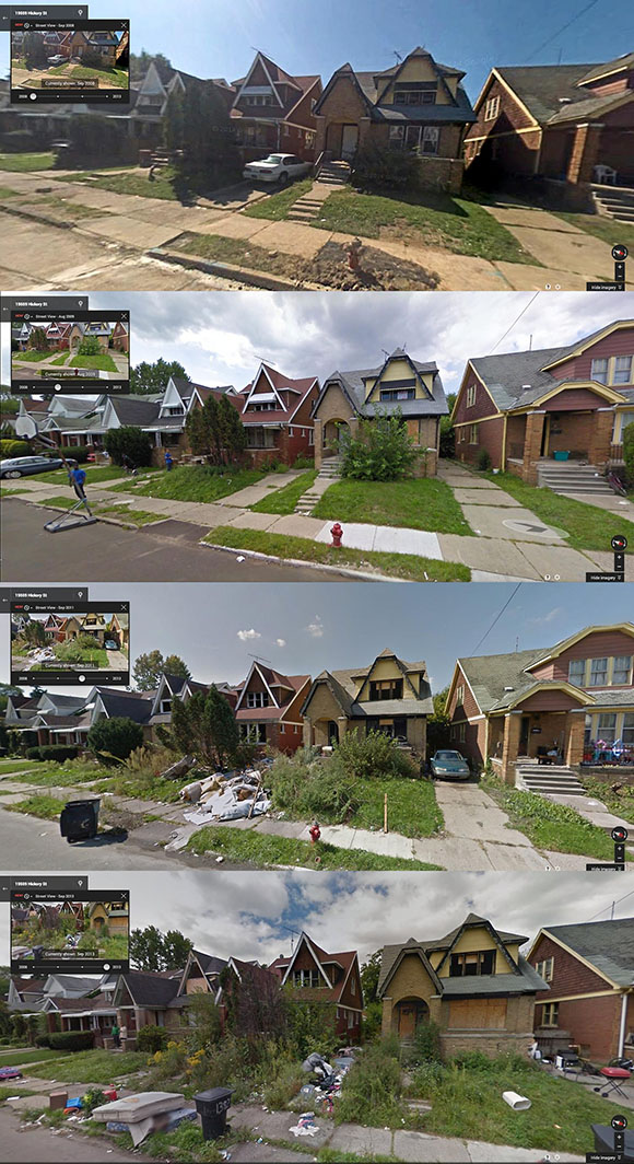
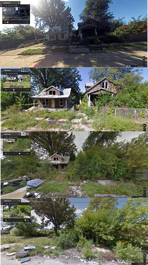
June 2014. The black-controlled city of Detroit’s ongoing collapse into ruins has been vividly captured on camera by Google streetview images taken over a five year period from 2008 to 2013.
The comparative streetviews show how the infrastructure of what was once one of the greatest cities in America—when it was majority white—is literally collapsing into ruins now that the European population has been ethnically cleansed from the city.
The racial sea change in Detroit provides the key to understanding the collapse in that city.
In 1930, 92.3% of Detroit’s population was white.
In 1940, 90.8% of Detroit’s population was white.
In 1950, 83.63% of Detroit’s population was white.
In 1960, 70.8% of Detroit’s population was white.
In 1970, 56.0% of Detroit’s population was white.
In 1980, 35.7% of Detroit’s population was white.
In 1990, 22.2% of Detroit’s population was white.
In 2000, 12.3% of Detroit’s population was white.
According to the 2010 US Census, some 7.8 percent of the city’s population was classified as white. This is however a self-classification, and the actual percentage of white people in this African and Hispanic city are substantially less, as any visitor will confirm.
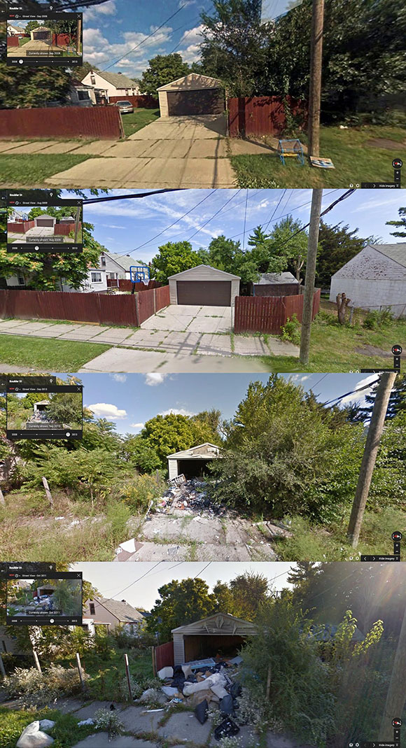
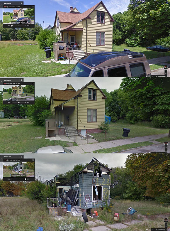
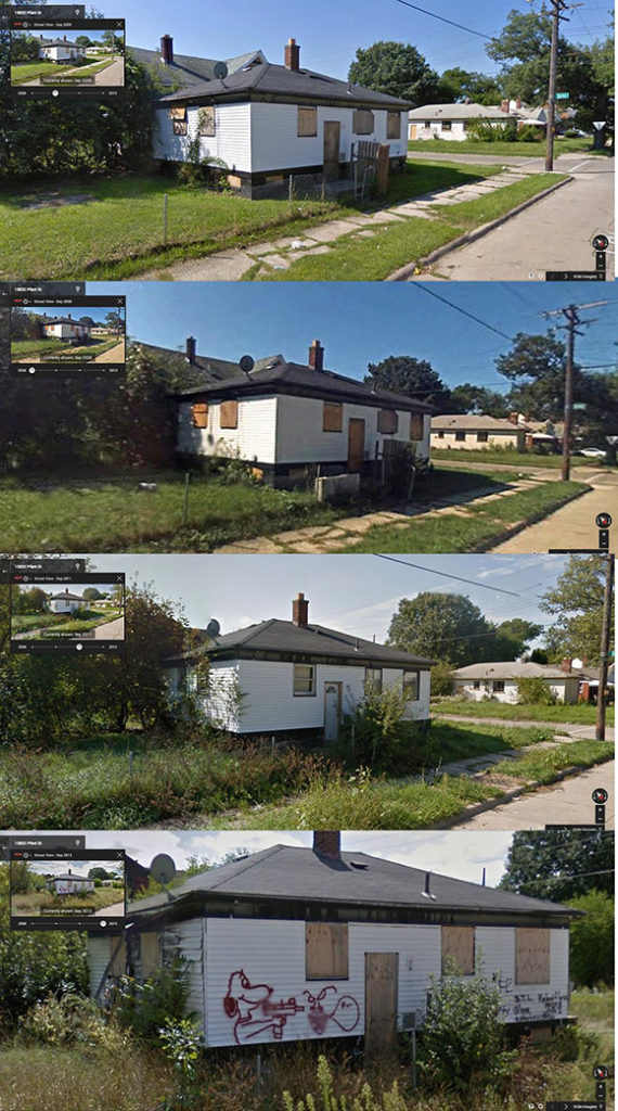
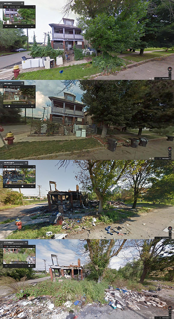
Thaddeus and Leigh Street


What is really sad is these people are proud to say they are from Detroit. Downfall of every great society and coming to a town near you.